Friday, September 27, 2013

Upper Mississippi River (Journey to the Head of Navigation Part 4)

Day 8  (9/13/13)     The temperature dipped into the upper 40's last night making for a great nights sleep but along with the cooler temps came a morning fog over the river valley. Once the sun popped up the haze dissipated and we were off.


 Morning haze on the water.

Pam enjoying her morning coffee.

There was barely a ripple on the water as we departed the pit. Sunny and cool enough that a light jacket was required for the first couple of hours. It wasn't long and we were cruising past Minnieska, Mn., the small town where the Ferris wheel was invented.

Minnieska tucked against the bluffs.

Nearby we spotted these Canadian Geese gathered in the shallows.

Expand the pic to find the geese.

The channel snakes around along the Minnesota bluffs before narrowing at Lock 5.

Bluffs above Lock 5.

The duckweed is starting to work it's way south along with other grasses that at times can cause problems by clogging sea strainers.

Duckweed inside the Lock 5 chamber.

We slipped through the lock and followed the channel past Fountain City, Wisconsin.

 Fountain City.

We locked through 5A without delay and slid past Winona on what was turning out to be a near perfect cruising day. A short while later we were at Trempeleau and entering Lock 6.

River above Trempeleau.

Trempeleau, Wisconsin.

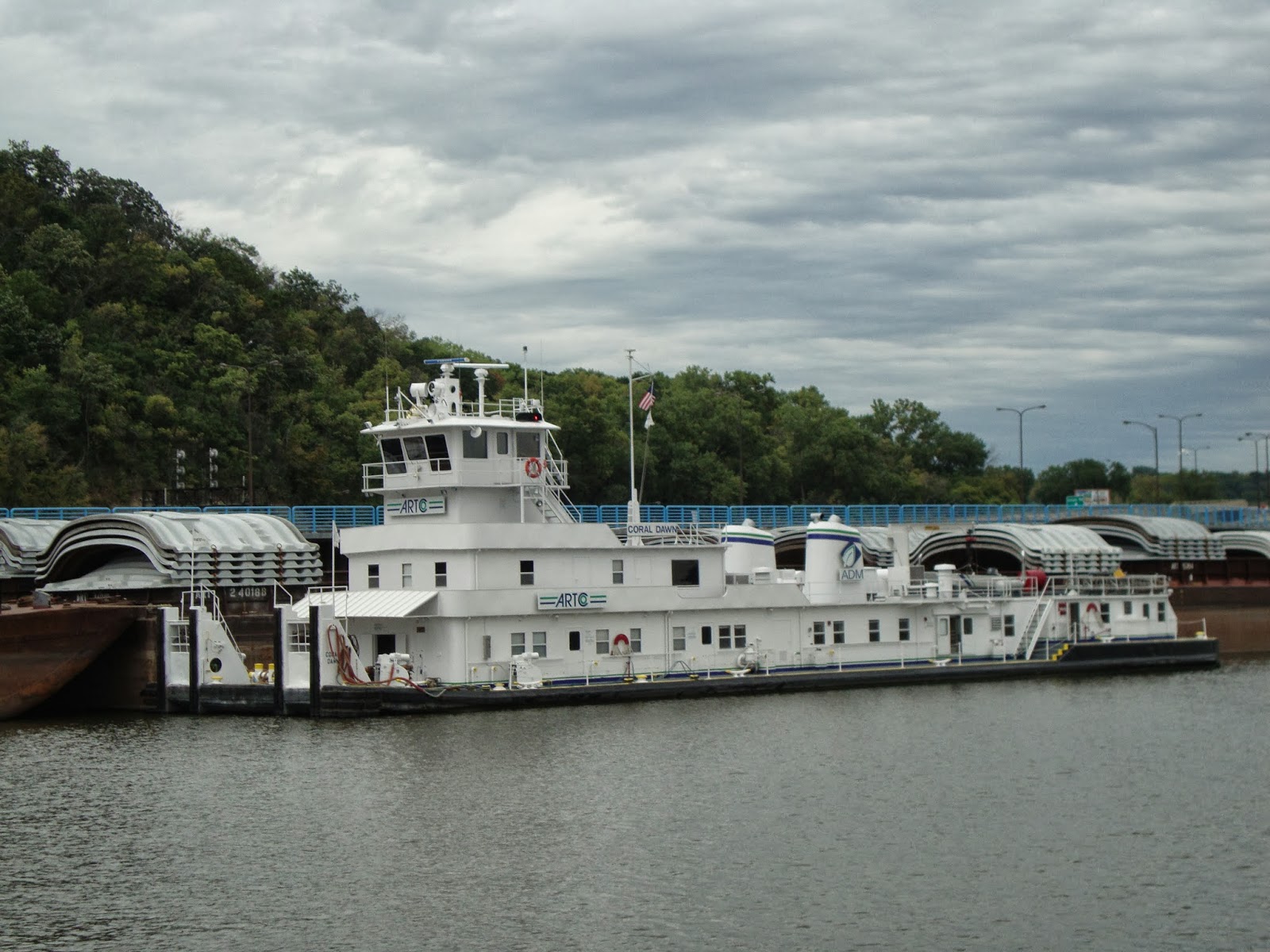
Still no traffic other than a few small fishing boats to keep us company as we continued following the current South. Eventually we came upon a small tug working at a dredging area. Once we were past he pulled out into the channel and followed us to and into Lock 7.

Ruby Belle in Lock 7 with us.

On our way upstream we had noticed what appeared to be a rental houseboat pulled into the shore and partially submerged below Lock 7. Once we were in the chamber we asked the lock attendant what the story was. His report was confirmed and added to by the attendant on our downstream trip.

Houseboat as we went upstream below Lock 7.

Houseboat as we exited Lock 7 downstream.

Here's the story. Sometime around the Memorial Day week-end this rental boat was above the lock and dam waiting to lock through to the South. The water was in flood conditions with very strong currents and the roller gates on the dam were wide open letting the water flow freely through it.
Gates in open position during high water. (picture of dam at Lock 11).

The houseboat was equipped with only one outboard engine as is so often the case on many of the rentals we have encountered over our years on the Upper Miss. According to the lock attendants this particular rental company was not noted for their upkeep of the equipment. Seems that several times they had caused delays at this lock because of mechanical issues. This time was definitely the worst of their problems.
The engine quit while above the lock and they couldn't get it running again. The current was swift and pulled them into the gates of the dam where eventually the effects of the fast moving water rolled the boat over and through the dam. There were 10 people on this boat and fortunately all were rescued alive with only minor injuries. The boat was towed to shore where it still sits today. Lawsuits are plenty as you can imagine and the shady operator has gone out of business.

That's the story we heard from the attendants as we transited Lock 7 in both directions. We learned of another on our return trip. This one doesn't have a happy ending.
Apparently around the same time as the above incident during high water a small tug was in a similar position above the lock waiting to pass through to the South. This tug was new with a small crew. Like the houseboat the engine quit and the current took the boat to the dam. The tug hit and rolled over while being pushed through the rollers by the rushing water. Unfortunately a 21 year old member of the crew was killed in this incident. Why the motor quit on this vessel has either not been determined or the cause has not been made public according to the lock attendant.

Our original plan for the day was to cruise through LaCrosse and on to a sand pit just above Brownsville, Minnesota but we were making such good time because of no lock delays that we decided to take advantage of the near perfect cruising conditions and shoot for the Gillette Island anchorage below Lock 8.

As we were about 5 miles out of the lock we could see a small southbound tow about a mile out. Knowing the pecking order at the lock we slowed down from trawler speed to idle speed thinking that he would be well through the locking procedure by the time we arrived at the lock. Wrong! Turns out the tow was the Mrytle Griffin, a 2 barge tow that we had encountered back at Lock 4.
When we got to the lock he was still positioning the barges in the chamber! He had the lead barge against the wall on one side and the stern of the tow against the other wall! WTF? Two barges and the boat should be able to fit into the lock with no problem. He then worked the stern over to the other wall and backed up with only one barge then pulled up beside the lead barge. Finally the gates closed and the water was lowered.
The process to re-couple the barges took almost as long. We've waited less time for 15 barge tows to lock through! But that's life on the river.

Finally through the lock we made our way the remaining 5 miles to our anchorage and caught up to the Myrtle Griffin shortly before we turned off the channel.

Mrytle Griffin slowly heading downstream along the Wisconsin bluffs.

Day 9 (9/14/13)     Cool temps again at night brought the morning fog along the river.

Looking down river from our anchorage.

Kim taking a picture of moist air.

When the fog began to lift we saw this northbound tow pushed into the river bank waiting for the fog to clear off.

Another great day as we passed the sign marking the boundaries of Iowa, Minnesota, and Wisconsin on our way to a stop at Lansing, Iowa for ice, water, and a precautionary pump-out.

Sign on shore marking the boundaries.

It's 10 a.m. on a Saturday as we pull in to a lifeless dock. We begin to put water into the tank expecting someone to come out of the building to see what we needed. No one in sight. The building was locked! Are we back in Red Wing? Finally a guy throwing a floaty into the river for his dog to retrieve said he would call the proprietor.

Dog retrieving the floaty.

Eventually a guy showed up and opened the place up. Said he had just come from a touch football game. Pump-out and icing (terrible ice) complete we continued on passing under the Blackhawk Bridge which was undergoing some refurbishment.

Looking back at the Blackhawk Bridge at Lansing with Mt. Hosmer looming over it.

Below Lansing the channel bends back across to the Wisconsin shore before running down to Lock 9. We came upon this northbound tow in that transition area.


 Don't cut to close to these guys. It takes them a mile to come to a stop!

On to and through Lock 9 without delay before we found our way to to the Marquette/McGregor area.

Lady Luck Casino boat at Marquette.

Looking back at the bridge to Prairie Du Chien, Wisconsin.

McGregor, Iowa waterfront.

A couple miles below McGregor we turned off the channel into Garnet Lake, an area we have anchored in several times over the years. Like so many places along the river it requires a cautious approach and an understanding of the effects of the current on the topography of the river bottom. Once inside we anchored in 9' of water.

Garnet Lake anchorage across from Pike's Peak.

Garnet Lake.

Relaxin'

Our last night out we had another great meal and the guys managed to keep from doing dishes.

Here we are again!

Happy not to be doing dishes!

Day 10 (9/15/13)     Rain! Once again the anchor came up relatively clean with only a little mud on the plow.
Back into the channel and past the small town of Clayton, Iowa.

Clayton, Iowa.

Below Clayton there is a huge cave in the bluffs that during the cold war was designated as a fallout shelter that could hold 40,000 people. Now it's used for storage.

Through Lock 10 and a stop in the rain at Landing 615 for fuel which we had called the previous day to insure that they would be expecting us and have fuel on hand. Once again, as is often the case on the river, we pulled in unassisted and tied off. Hmmm. No one around and the door is locked. Back in 5 minutes the sign said. We waited. And waited. And finally started calling the numbers on the door. In about 10 minutes a couple of men showed up, neither of who were supposed to be working that day, and began the fueling process. After about 5 gallons pumped the process stopped. After some investigation they determined they were out of fuel. Grumble, Grumble! Somebody dropped the ball! Eventually the attendant on duty showed up. The good news is that we weren't out of fuel and the 5 gallons we pumped we got at no charge!

Off we went on to and through Cassville, Wisconsin passing the two power plants located there as well as The Pride of Cassville, a car ferry that connects Iowa and Wisconsin.

 Cassville power plant.

Pride of Cassville ferry.

On downstream we continued with the girls rounding up our loose articles and packing for our return home. Before long we were above Lock 11 at Dubuque.

Heading to Lock 11.

Gates are opening.

Too soon after locking through we were pulling into Mid-Town Marina and the slip.

Mid-Town.

Many thanks to Kim and Lu for including us in their adventure and providing us with great company and another check mark on the bucket list.


Tuesday, September 24, 2013

Upper Mississippi River (Journey to the Head of Navigation Part 3)

Day 5 continued  9/10/13     12:30 p.m. was our turn around time at MM 857.6. It's all downhill from here.
Lucky for us the small tow that we followed through the locks was still switching barges at one of the terminals so our return path was unimpeded. We dropped back down the 112 feet that we had risen in the three locks and decided to continue back downriver to an anchorage near Prescott,Wisconsin. Our only hurdle remaining for the day would be Lock 2 near Hastings, Mn.

Here are a few pictures taken of the rest of the days trip:


Minneapolis skyline.

Upper St. Anthony Falls from the top side.

Cells placed strategically to keep boats from being pulled into the falls.

Inside the Upper lock.

Approaching Lower St. Anthony's from above.

Weisman Art Museum at the U. of Minnesota.

Lock 1 infinity pool above the chamber.

Local excursion boats.

Old towboat made int a B & B.

Colorful housing in St. Paul.

St. Paul skyline.

M/V Coral Dawn tied below St. Paul.

We traveled unscathed back through the fleeting areas and found the lock at Hastings waiting for us. Good news. Our anchorage isn't too far from the lock. Just a left turn at the St. Croix and around the corner to Douglas Point.

Looking back at Prescott from our anchorage at Douglas Pt. on the St. Croix River.

A view to the North of the St. Croix valley.

By the time we dropped the anchor and started cocktails we had covered approximately 60 miles and made 7 lockages.

Day 6  9/11/13     ALWAYS REMEMBER!

The weather is always a big factor when traveling by boat. We've been very fortunate in only having an hour of rain so far and mild to hot temperatures.
Today we slipped under the bridges at Prescott and re-entered the Mississippi headed for Lake Pepin and an anchorage near Long Point. Only Lock 3 and Red Wing to transit.

 The river below Prescott.

Cleaning up a shallow spot in the channel above Red Wing.

Our plan was to make a short stop again at Red Wing Marina to pump out, take on water, grab some ice, and make a quick run to the grocery store. Simple plan thrown awry by the marina being closed and absolutely no one around. We did manage to fill the water tank before shoving off. We next pulled into the sea wall downtown for the short walk to the grocery store. Still in need of the pump out we ventured south of town to Bill's Bay Marina. No answer on the radio or the phone but there were a couple of guys working on the dock. The question of are you open was met with the response of  "No, but what do you need?" When told ice and a pump out we were pleased to find that they could accommodate us on both counts. How do you spell relief!
Mission finally completed we cruised on into Lake Pepin.

Maiden Rock bluff so named because of an Indian maiden who allegedly jumped to her death from this point rather than marry the warrior picked by her father.

By the time we arrived at Long Point the wind was gusting into the mid 20's from the North causing a bit of a chop on the lake. The preferred anchoring spot is on the North side of the point but would have been uncomfortable so we felt our way into a 5' spot below the point and calm water.

Our anchorage at Long Point once the site of a French fort built in 1700.

The water temperature was still near 80 degrees and the forecast was for the temps to start dropping in the days to come. With that in mind I took the opportunity to take my one and only river bath for the season. With Ivory soap in hand (it floats) I slid off the back of the boat and promptly found myself standing on the sandy bottom up to my neck. Mission complete I rinsed off with the transom shower and put on my tuxedo for dinner. Sorry no pictures of either event!

Pam's Asian salmon and some green stuff for dinner. The milk is mine!

Day 7  9/12/13     The sun was shining brightly as we pulled anchor and headed a short distance downstream to Hansen's Harbor Marina just above Lake City, Mn. to fill the fuel tanks. Hansen's isn't the snazziest marina but they're friendly, helpful, and have probably one of the best stocked ship's store's on the Upper Mississippi. And oh, their fuel is competitively priced. It's always a pleasure to make this stop.

   Hansen's Harbor entrance. Narrow but deep.

 M/V Vagabond at Hansen's fuel dock.

After our stop was complete we slipped back onto the lake and continued on to our next destination, Pepin Marina in Pepin, Wi.. Now Pepin Marina in itself is not what I would consider a destination. Too close to the RR crossings. The reason we stop is to go to the Harbor View Cafe. (www.harborviewpepin.com). The meals have always been unique and a notch above your normal bill of fare. Harbor View isn't a large place and you won't find a menu on the table. It's on a chalk board hanging behind the bar.


Harbor View Cafe in Pepin, Wisconsin.

Satisfied diners.

As a side note, Pepin, Wisconsin is also the birthplace of Laura Ingalls Wilder and Lake Pepin is the birthplace of water skiing.

Downtown Pepin from the marina. Not very big!

Fat and happy we left Pepin for our final leg of the lake.

Northbound tow on the lake. Not so big from a distance!

Minnesota bluffs at the south end of Lake Pepin.

We entered the river once again and passed by a huge sandbar that was once a large sand pit. The Corps of Engineers digs out areas of the islands to make a deposit area for the sand that is dredged from the river channel. Usually these pits are about 20' deep at center and an opening is cut to the river so it can fill with water making a great recreation area for boaters. Over the years as the channel fills in the dredges come along and pump the sand from the river into these pits eventually filling them in as this one has been.

Filled in pit now just a pile of sand.

On through Wabasha and on to Alma, Wisconsin where we had to wait a few minutes for the Myrtle Griffin to clear the lock and the water to be brought back up for us.

  M/V Myrtle Griffin leaving Lock 4.

Southbound BNSF train passing us as we wait at Lock 4.

After the lock we pulled in to the Alma courtesy dock just below the lock and strolled through the little town. Like so many small towns it has been punished by the times with many of the store fronts vacant. We did find a few shops still going and made a small contribution to the local economy.

Alma's main drag.

Just a few miles below Alma we had noticed a sand pit on our way upstream. Time to call it a day!
We crept our way in finding no less than 6.5 feet at the entrance and 20' at the pits center. We shared the spot with 2 rental houseboats and had a peaceful night.

 The deckhand burying the anchor in the sand.

The view towards the lower end of the pit.

Looking towards the upper end.


The final leg yet to come.....