Day 4 (9/9/13) Another hot day on the way with temps forecast to be in the mid 90's! With that in mind we got out of Dodge before things warmed up. Three miles later we were locking through Lock 3, again our timing was good. Just as we left the chamber a southbound tow came around the corner. We met on a tight turn but a call to the towboat assured us that we would have enough room if we passed on the "one whistle".
Looking north from our slip just before we pulled out of Red Wing.
Meeting on the "one whistle" above Lock 3.
Once past the tow we had clear sailing up to Prescott where the Mississippi and St. Croix Rivers meet. This trip we turned left for the first time ever. In the past it was under the bridges and up the St. Croix.
Jct. of Mississippi & St. Croix. We went left.
Before long we were passing Hastings and cruising into Lock 2. Once again the deckhands were out holding on to the lines dropped from the lock attendant while capt. Kim relaxed in his helm seat.
It's good to be the skipper.
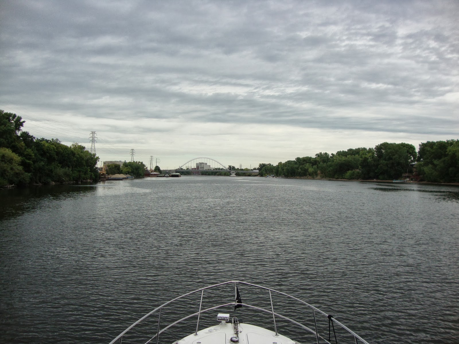
The channel runs by the rock bluffs above Lock 2 before zig zagging back and forth on it's way to the Twin Cities.
Rock bluffs above Lock 2.
Soon enough we came upon a railroad bridge. A call on the radio asking for the current clearance resulted in a question of how much did we need. When told, the bridge tender replied that we had plenty of room to pass under. (There are very few bridges on the river that have the height gauges on them like you find on the ICW.)
Even though we had "plenty of room", the bridge tender had a local switch engine hold position on one side of the bridge till we were safely under.
Train engine waiting for us to clear.
He was right. Plenty of room!
By now we were approaching S. St. Paul. A very industrialized area with many barge fleeting areas both along and off the channel.
We passed this guy as we entered Lake Pepin yet he beat us to this point.
Also along the route was the airport in S. St. Paul.
The industry continued almost into the downtown area of St. Paul.
Coming into St. Paul.
Bridge construction greeted us as we neared downtown.
More bridges.
M/V Theresa L Wood tied to the wharf in the downtown area.
The state capitol where Jesse Ventura once reigned over the state.
Once through St. Paul the river narrows and seemingly disappears from it's metro surroundings. It was hard to imagine the hustle and bustle of the cities hiding behind the trees on either bank.
Where are the buildings and people?
Even the junction of the Minnesota River appears to be in the wilderness.
A short distance later we pulled into Watergate Marina at MM 845. Still hard to believe that just up the hill were thousands of people. That evening we summoned a cab to take us to The1029 Bar Nordeast (
www.the1029bar.com) for dinner. 1029 was featured on Diners, Drive In's, & Dives and and had been calling to us since we left home. The cab ride never seemed to end. Turns out 1029 was farther away than we realized and subsequently we spent more on the round trip cab fare than we did on dinner! Even though we went over our transportation budget the meal didn't disappoint. Food in the bar is provided by the Smack Shack restaurant and lived up to the hype
Day 5 (9/10/13) With a minimum of 6 lockages ahead of us for the day we snuck out of the marina before 9 a.m.right back into the hidden river.
There may be civilization ahead.
Three miles later we closed in on Lock 1. But not before passing a
group of seniors doing yoga in the park.
Floating bollards. Our favorite way to tie off in a lock.
After Lock 1 we started seeing signs of life along the river.
Bridges must mean people.
University of Minnesota Medical Center.
Downtown Minneapolis looms in the distance.
Next up was the Lower St. Anthony Falls Lock.
Lower St. Anthony Falls Lock.
We encountered a 2 barge tow in the Lower lock and had to wait a few minutes for the water to drop back to our level.
Once out of the lock it's almost immediately that you enter the Upper St. Anthony Lock. Again the tow was just getting into the lock. We could have entered along side the barges if we desired but chose not to when we saw how tight it would be. The lock chamber is only 400 feet long and 56 feet wide. A normal barge is 35' wide. Because of the length of the tow the towboat had to disconnect and pull in beside the barges for the ride up.
Approaching Upper St. Anthony's in downtown Minneapolis.
Tow entering the Upper Lock.
Our view of the Upper St. Anthony Falls from our waiting spot.
Refurbished factory buildings near the locks.
Our turn came just as it started to rain.
In we go.
Out of the chamber and still raining I figured I might as well switch the fenders for the ride back down.
My uncles used to drink this less than "Premium" beer when I was much younger.
Almost to the turn around point.
The train bridge at mile 857.6 that marks the end of the maintained navigation channel on the Upper Mississippi.
The red icon shows we made it as well as the notification on the right side of the plotter. Pam and I have now covered the entire length of navigable water on the Upper River. Next??? Maybe Cairo to New Orleans!
Stay tuned for the ride back...


No comments:
Post a Comment